

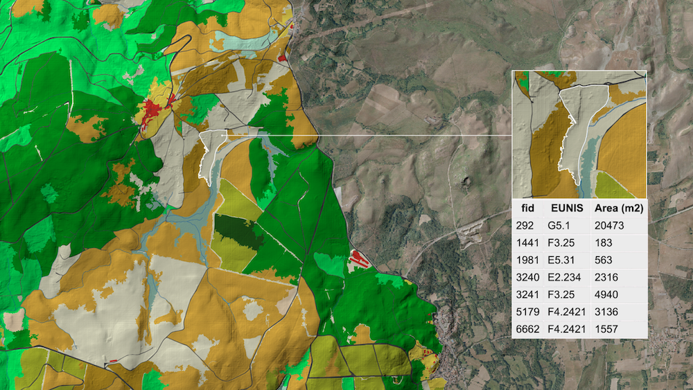
habitat mapping
Habitat maps provide essential information for protected area managers and policymakers, addressing questions such as:
What is the extent of different habitats in our area?
How should we manage the territory effectively?
Can we permit construction of structures like barns or roads in specific areas?
How suitable is the landscape for species like bears?
How fragmented are the habitats, and where should we create ecological corridors?
Which protected habitats have been impacted by recent fires?

The creation process

The creation of a habitat map is a highly interactive process involving you as the local expert, our Solution Partner 3edata for classification, and our team. It involves six key steps:
-
The specific area for mapping is determined.
-
Sensing Clues’ Ecosystem Base Map is used to gather satellite data and produce cloud-free mosaics.
-
False-colour imagery is employed to identify areas for ground-truth validation, with these locations marked in the Cluey Data Collection App.
-
Ecologists then visit these marked locations to verify and classify the habitat.
-
3edata uses the collected data to develop a habitat classification model and create an initial map.
-
Knowledge rules are applied to improve the classification results and generate the final habitat map.
Habitat mapping is a solution that is part of our Project Subscription Plan.
Are you interested in a habitat map?
Credits
Habitat mapping routines are being developed by Nature FIRST, a Research and Innovation Action (RIA) from HORIZON-CL6-2021-BIODIV-01-02 Call (grant Agreement ID 101060954) that has received funding from the European Union’s Horizon Europe Research and Innovation programme.


